-
![Application Screenshot showing NS Railroad network and weather across the Eastern half of the United States]()
NSGIS 4.0
Developed SaaS Web Mapping Product that increased performance up to 200X while enhancing user experiences across the board. React/TypeScript/ArcGIS JS API/Oracle Spatial DB, AWS integration with ArcGIS Online, Google Maps, Bing Maps, NOAA Weather Data APIs, ESRI Satellite Imagery Services, and 120+ ArcGIS Server API’s, Big Data pipelines, AI/ML derived data & video feeds. Used daily by 3,000+ internal users to aid mission-critical decision making related to railroad operations and safety.
-
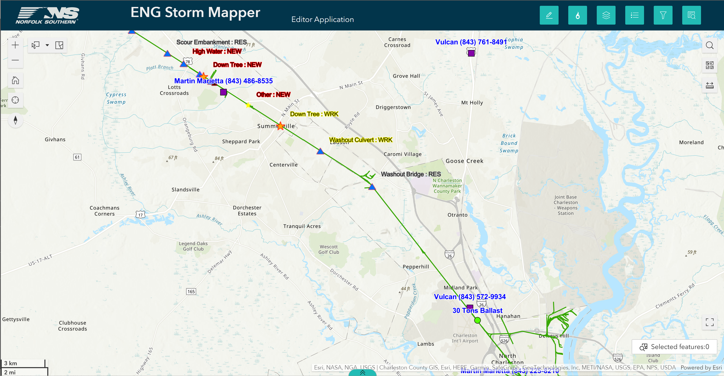
![Application Screenshot showing Hazard Mapping on a portion of Railroad]()
Storm Mapper
Hybrid-cloud, SaaS Web and Mobile mapping platform. Utilizing ArcGIS JavaScript API, ESRI Field Maps, ArcGIS Online, ArcGIS Mobile, & ArcGIS Server technology leading to more efficient real-time emergency response, increased coordination, and improved situational awareness for 300+ emergency and front-line responders in the field.
-
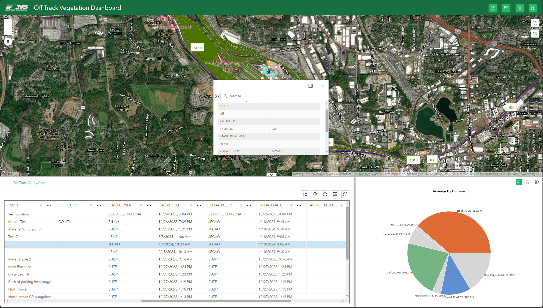
![Application Screenshot showing Vegetation Tracker Website with Pie Chart and Map]()
Vegetation Planner
Cloud-based, Vegetation Management GIS Platform. ArcGIS Online/ArcGIS Server/ ArcGIS Javascript API/Oracle Spatial Backend. Allows Leadership Teams to track vendor spray locations and plan work using vendor gps, coverage models, satellite imagery, and detailed railroad spatial datasets. Leading to more efficient program management and saving hundreds of thousands of dollars every year in wasted work allowing for more precise budgeting as well as clearer communication and more efficient vendor management.
-
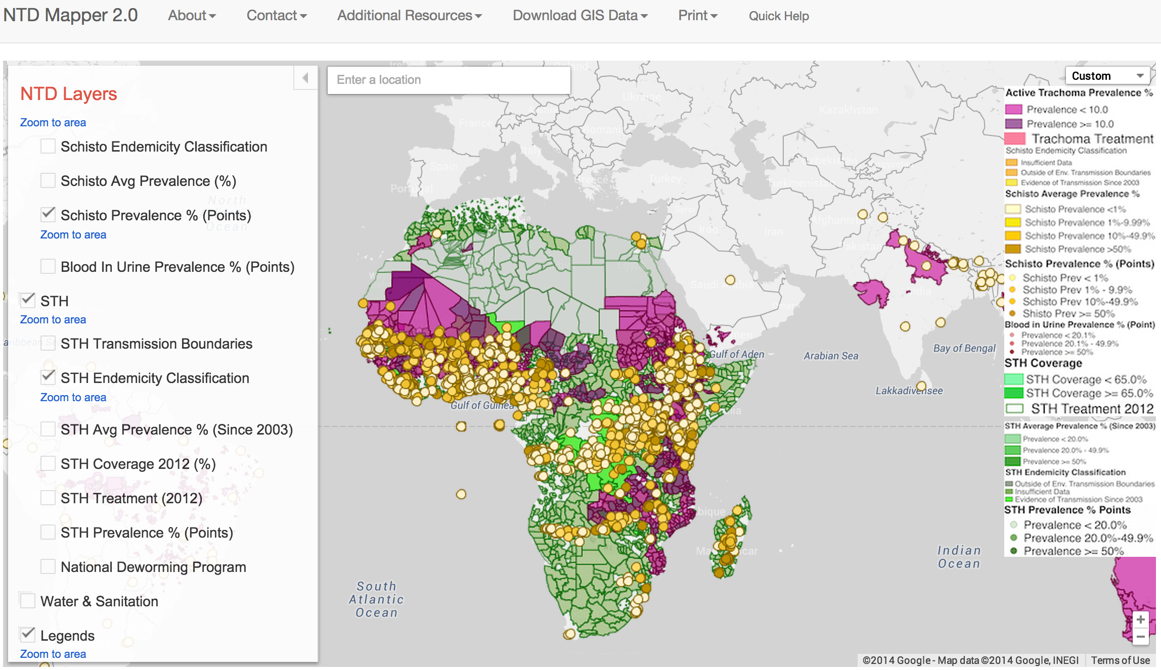
![software screenshot of NTDMap showing a colorful map depicting neglected tropical disease diseases across the globe.]()
Trachoma Atlas/NTD Map
Open Source Web Mapping Platform built for The Task Force for Global Health, Bill and Melinda Gates Foundation, and International Trachoma Initiative for tracking Neglected Tropical Diseases and Medicine Distribution in Africa and India. Google Maps/Earth Engine, Google Sheets, QGIS, D3.js, Bootstrap.JS, CartoDB PostgreSQL backend
-
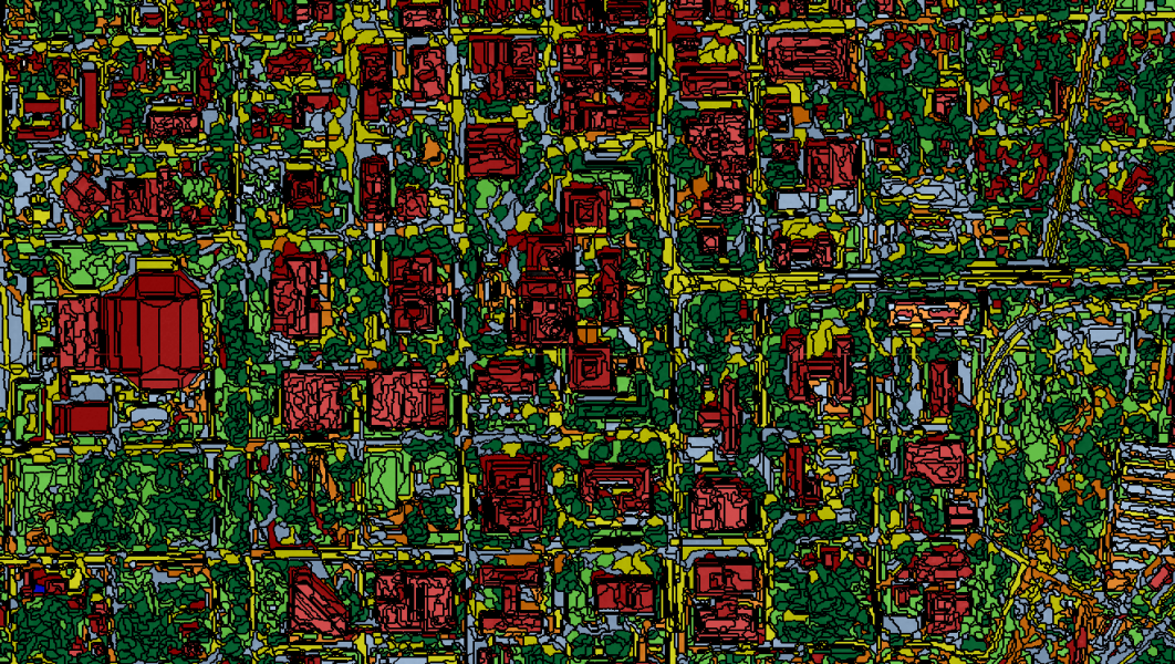
![Downtown Tallahassee Florida segmented with custom Object-based Image Classification Algorithms.]()
Object Detection & Satellite Image Classification
Build Object-based Image Classification Machine Learning Algorithms to enhance feature detection in Satellite Imagery. Integration of information from LiDAR derived DSMs, DEMs, DBMs, and High-Resolution (GEOEYE-2) Satellite Imagery. Utilized Trimble eCognition, MARS LiDAR, ERDAS Imagine, IDRISI Software.
-
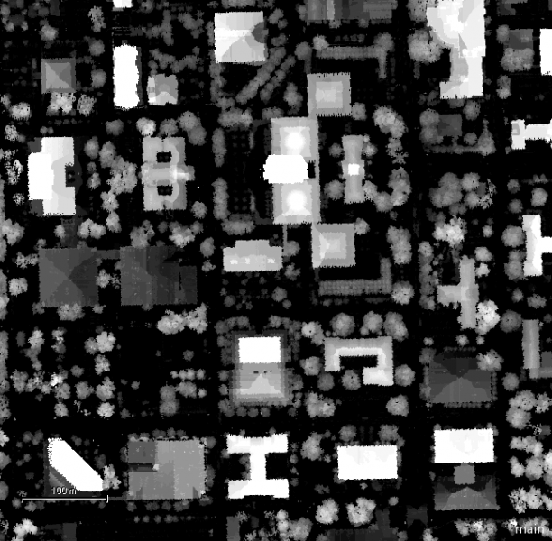
![Lidar Digital Elevation Model of Tallahassee, Florida.]()
LiDAR Processing
Process raw LAS/LiDAR Point Clouds using, MARS LiDAR Viewer, ERDAS Imagine, IDRISI, and custom python scripts. Create custom algorithms to create Digital Elevation Models (DEMs), Digital Surface Models (DSMs), and Digital Building Model (DBMs) to enhance feature extraction.
-
![Map of Downtown Tallahassee built with Leaflet JS API]()
Mobile Mapping Apps
Use Custom HTML, JavaScript, React, & C#/.NET Libraries, iOS SDKs, ArcGIS JavaScript APIs and other frameworks to develop and deliver custom Mobile and Web-based Mapping Applications. Using On-Prem or Cloud-based hosting including ArcGIS Online and Open Source GIS Platforms.
-
![False Color vegetation imagery of downtown Tallahassee, FL showing vegetation in red and impervious surfaces in teal.]()
Vegetation & Building Detection
Develop and deploy cutting edge Machine Learning Image Processing algorithms to detect and monitor vegetation, buildings, and urban morphology changes using imagery and LiDAR collected from various sources such as satellites, drones, and aerial platforms. Can be leveraged for change detection when combined with time-series imagery.